Completion of 1st Year Surveyor Training from a recognized ITI or diploma institution
Trade Theory – III
Leveling:
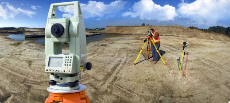
Dumpy level and leveling staff usage
Types of leveling (differential, fly)
Contour surveying
Theodolite Surveying:
Types and parts of a theodolite
Angle measurement (horizontal/vertical)
Traversing using theodolite
Trade Practical – III
Performing differential leveling
Contour plotting for small areas
Use of transit theodolite for angle and distance measurement
Traverse adjustment and plotting
Engineering Drawing – III
Drawing of contour maps
Cross-sections and profile leveling
Theodolite traverse plotting
Workshop Calculation & Science – III
Trigonometric height calculation
Traverse calculations and corrections
Use of sine/cosine laws in fieldwork
Employability Skills – III
Team collaboration in field projects
Industry behavior and job roles
Safety practices at work sites
Trade Theory – IV
Tacheometry and Total Station:
Tacheometric methods and constants
Introduction to total station
Basics of electronic distance measurement (EDM)
GPS & GIS (Introductory):
GPS for positioning and navigation
Basics of GIS and map layering
Road and Building Project Layouts:
Curve setting
Layout of residential buildings, roads, and drainage
Trade Practical – IV
Total station use for data collection
Layout of a small building using theodolite
Road alignment and curve setting
GPS-based location plotting (demo/project-based)
Engineering Drawing – IV
Plan, section, and elevation drawings
Road profiles and horizontal curves
Plotting using data from total station
Workshop Calculation & Science – IV
Mass haul diagrams
Use of coordinates and bearings
Volume computation (cut and fill)
Employability Skills – IV
Resume writing and job interview preparation
Career pathways in land records, construction, GIS
Introduction to freelancing in surveying
Final Project Work & Viva
Field project using theodolite or total station
Complete surveying of a plot/site
Drawing submission and viva by examiner

Course Code : M-ITIMM01

Course Code : M-ITIMM02

Course Code : M-ITIEVM01

Course Code : M-ITIEVM02

Course Code : M-D-MLT01

Course Code : M-D-MLT02

Course Code : M-ITIADS01

Course Code : M-ITIADS02

Course Code : M-DHSI01

Course Code : M-DHSI02

Course Code : M-ITIDM01

Course Code : M-ITIDM02

Course Code : M-ITIDMC01

Course Code : M-ITIDMC02

Course Code : M-DBM01

Course Code : M-DBM02

Course Code : M-DFD01

Course Code : M-DFD02

Course Code : M-CFT01

Course Code : M-CFT02

Course Code : M-ADCA01

Course Code : M-ADCA02

Course Code : M-DHM01

Course Code : M-DHM02

Course Code : M-HM01

Course Code : M-HM02

Course Code : M-DRM01

Course Code : M-DRM02

Course Code : M-PTT01

Course Code : M-PTT02
Course Code : M-ITISP01

Course Code : M-ITISP02

Course Code : M-CMS01

Course Code : M-CMS02
Course Code : M-ITIE01

Course Code : M-ITIE02

Course Code : M-ITIEN01
Course Code : M-ITIEN02

Course Code : M-ITIF01

Course Code : M-ITIF02
Course Code : M-DJMC01

Course Code : M-DJMC02

Course Code : M-DPE01

Course Code : M-DPE02

Course Code : M-CMSED01

Course Code : M-CMSED02

Course Code : M-NTT01

Course Code : M-NTT02

Course Code : M -01

Course Code : M-02

Course Code : M-03

Course Code : M-04

Course Code : M-05

Course Code : M-07

Course Code : M-08

Course Code : M-09

Course Code : M-10

Course Code : M-11

Course Code : M-12

Course Code : M-13

Course Code : M-14

Course Code : M-15

Course Code : M-16

Course Code : M-17

Course Code : M-18

Course Code : M-19

Course Code : M-20
Course Code : M-21
Course Code : M-22

Course Code : M-23

Course Code : M-24

Course Code : M-25

Course Code : M-26

Course Code : M-27

Course Code : M-28

Course Code : M-29

Course Code : M-30

Course Code : M-31

Course Code : M-32

Course Code : M-33

Course Code : M-34

Course Code : M-35

Course Code : M-36

Course Code : M-37

Course Code : M-38
Course Code : M-39

Course Code : M-41
Course Code : M-42

Course Code : M-43

Course Code : M-44

Course Code : M-45

Course Code : M-46

Course Code : M-47

Course Code : M-48

Course Code : M-49

Course Code : M-50

Course Code : M-51

Course Code : M-52

Course Code : M-53

Course Code : M-54

Course Code : M-55

Course Code : M-56

Course Code : M-57

Course Code : M-58

Course Code : M-59

Course Code : M-60

Course Code : M-61
Course Code : M-62

Course Code : M-63

Course Code : M-64

Course Code : M-65

Course Code : M-66

Course Code : M-67
